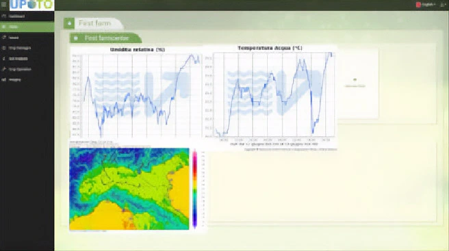
The CO2 Land Viewer allows the graphical and analytical analysis of soil ability to sequestrate Carbon Dioxide.
It offers a complete spacial and temporal overview of the carbon exchange between the atmosphere and the soil, allowing the analysis and tracking of local, regional and national behaviours.